How to open Garmin .RSD sonar files on a Mac or PC.
A Garmin chartplotter can record its sonar to the memory card as an .RSD file. Opening one on a computer takes software that reads Garmin's format. This guide covers what's in the file, how to get it off the card, and how to look at it on macOS or Windows.
The file
What an .RSD file is.
RSD is the format Garmin units use for sonar recordings. While recording is on, the unit writes every ping to the card: the ClearVü down scan and SideVü side scan returns, along with the boat's GPS position, depth, speed and water temperature at each moment.
That makes an .RSD file a complete record of the trip, not a screenshot of it. You can scroll back to any point, look at the bottom you passed over, and find where it was. The catch is size: an afternoon at survey speed is tens of thousands of pings, far too many to scrub through frame by frame.
On the water
Recording one on your Garmin.
Put a memory card in the unit before you start. On most Garmin chartplotters, sonar recording is switched on from the sonar page's menu, under an option called Sonar Recording or Record Sonar. The exact path depends on the model; if you can't find it, your unit's manual lists it under sonar recording.
For recordings you can read later, hold a steady speed and a straight line over the water you care about. Side scan in particular is easiest to read when the boat isn't turning.
At home
Getting it off the card.
Turn the unit off, take the card out, and put it in your computer with a card reader. The recordings are the files ending in .RSD. Copy them somewhere safe, or open them straight off the card.
On your computer
Opening it in BrushFinder.
BrushFinder runs on macOS and Windows and decodes .RSD files on your own machine. Pick a recording, or point it at the card and it decodes every recording on it, skipping any it has already done.
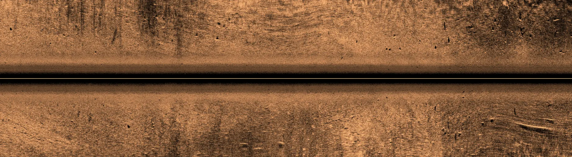
Once a recording is decoded you get the ClearVü down scan, the SideVü side scan shown upright at true distances, and a playback of the trip as it was logged. BrushFinder also scans the whole recording for brush piles and standing timber, marks each find on the imagery, places it on a map at its real latitude and longitude, and exports the ones you keep as GPX waypoints for your chartplotter.
One pass of SideVü from an .RSD file, as BrushFinder renders it.
BrushFinder reads Garmin .RSD files only. It doesn't open Humminbird or Lowrance recordings today. It reviews recordings after the trip; it doesn't connect to your chartplotter on the water, and its positions come from the recording's own GPS track and are not for navigation.
Questions
Opening .RSD files: questions.
Can I open Garmin .RSD files on a Mac?
Yes. BrushFinder runs on Macs with Apple Silicon (macOS 13 Ventura or later) and on Intel Macs (macOS 14 Sonoma or later).
Can I open Garmin .RSD files on Windows?
Yes. BrushFinder runs on Windows 10 or later, 64-bit.
Will it read my unit's recordings?
BrushFinder reads .RSD recordings with ClearVü down scan and SideVü side scan. The free trial has every feature, so you can check it reads your own files before you buy.
Does it open Humminbird or Lowrance sonar logs?
Not today. Garmin .RSD only.
Do my recordings get uploaded anywhere?
No. Decoding happens entirely on your machine. The one exception is yours to make: if you switch on AI and connect your own account, sonar images and trip details go to that AI company. It's off by default.
Does it need the internet?
Opening recordings, scanning and the sonar views all work offline. The map and the AI features need internet, and the trial needs to connect at least once a day.
How do I get the finds back onto my chartplotter?
Export them as a GPX file of waypoints and load that file on your chartplotter.
Try it on water you already know.
Seven days, every feature, no card. Decoding happens on your machine, and your recordings stay there unless you switch on AI.